Texas Treks Through Time
By Beth Stricker, Chief Creative Officer, Witte Museum
The land around you has not always been as you see it now. The planet is in a constant state of change.
Earth’s outermost layer, the lithosphere, is made up of 15 to 20 large rocky plates. These plates sit on top of the mantle, a thick, viscous layer of partially molten rock. The mantle’s intense heat causes the plates to move slowly over time. At the “seams” where the plates meet, this movement can create earthquakes, volcanic eruptions or mountains.
Two hundred and fifty million years ago, the lithosphere only had one continent – Pangaea – and one massive ocean – Panthalassa. Earth’s mantle heated and cooled repeatedly, breaking Pangaea apart and moving the pieces around the planet. These plates move more quickly than you might think! The plates drift together and apart at an average rate of about 1.5 cm (.6 inches) each year. Some areas move even faster – almost 5cm (2 inches) a year.
In the special exhibition Antarctic Dinosaurs, you’ll discover how these movements shaped Antarctica’s climate and ecosystems over time, but what about Texas? The area of land we now call Texas has moved and changed drastically over the course of Earth’s history. Oceans have risen and receded, greatly influencing the plants and animals living here.
THE PERMIAN PERIOD
299 to 252 million years ago
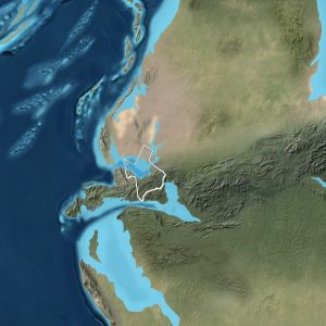
In the Permian, Texas included a shallow sea, a desert and a mountainous peninsula. The shallow coastal waters were home to coral reefs, ammonites, brachiopods, sharks and rays. On land, the first seed-bearing plants began to spread, cicadas and beetles flourished and larger vertebrates like Dimetrodon roamed.
How do we know? Much of the north-central Texas and west Texas bedrock was formed in the Permian. In these regions, paleontologists have uncovered fossils of sea life, terrestrial life and even a barrier reef. One of the most impressive records of the long-dry Permian reef is the Capitan Formation in Guadalupe Mountains National Park, which has been described as “the largest, best-preserved, most accessible and most intensively studied Paleozoic reef complex in the world.”
THE LATE TRIASSIC
237 to 201 million years ago
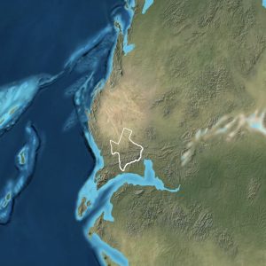
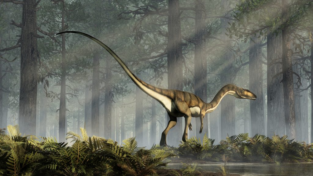
By the Late Triassic, Texas was a tropical inland waterway surrounded by mountains. On land, tall pine-like evergreen trees and cycads grew, while ferns and horsetail rushes grew in swamps and streams. Reptiles thrived on land, water and sky. Pterosaurs soared through the air, crocodile-like Phytosaur lurked in waters and, on land, the earliest dinosaurs began to roam. These dinosaurs, ranging from dog-sized to ostrich-sized, included Technosaurus, Coelophysis and Shuvosaurus.
How do we know? Triassic aged rocks and fossils are located in north-central Texas, in the High Plains north of Amarillo, in the Caprock south of Lubbock and to the south and east of Big Spring. Texas “redbeds,” the sandstone and red mudstone rock sites of west Texas, are one of the best sources of Triassic fossils. Paleontologists have found evidence in this region of turtle-like reptiles, small mammals and early dinosaurs.
THE CRETACEOUS PERIOD
145 to 66 million years ago
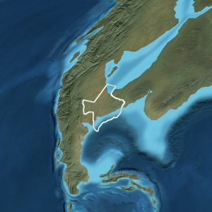
During the Cretaceous, most of Texas was covered by a large inland sea that split North America in two.
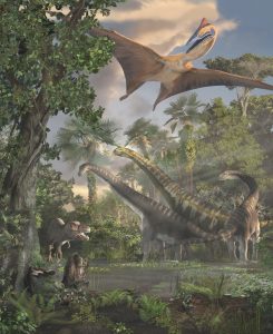
About 110 million years ago, Acrocanthosaurus walked across an ancient shoreline in what is now San Antonio. Thirty-eight million years after that, some of the largest animals to live in North America populated the area, including Tyrannosaurus rex, the long-necked Alamosaurus sanjuanensis and the pterosaur Quetzalcoatlus northropi. Other animals included amphibians, birds, marine reptiles, fish and turtles, as well as invertebrates, such as ammonites and jellyfish. On land, trees and grasses spread.
How do we know? Almost twenty-five percent of Texas today sits upon Cretaceous rock. Within it, preserved remains of plants and animals from land and sea indicate that this was a time of rising and falling sea levels. Paleontologists have discovered fossilized shark teeth, fish scales, sea urchins and marine reptile bones. At Government Canyon State Natural Area, hundreds of theropod dinosaur tracks are preserved in rocks of the upper Glen Rose Formation. These tracks indicate multiple animals traveling alone along the ancient shoreline 110 million years ago.
Learn more about Texas’ trek through time in the Naylor Family Dinosaur Gallery.
Witte Museum Members Magazine | Spring 2023
Period depictions provided by © 2016 Colorado Plateau Geosystems Inc.
